How I Built a $0 Space-Based Fire Alert System
When you live in the forest and wildfire season is a real thing, you get creative. Here's how we turned NASA satellites into our personal fire watch.
JB: Before we dig in, obligatory shoutout to WatchDuty, the mobile app. It's a 501(c) ran system that is different, but similar, to this concept. I wanted something faster that I could innovate on top of, not to replace their amazing project. If folks have a real need for wildfire tracking, highly suggest their project: https://app.watchduty.org
Most people find out about nearby wildfires the same way: a neighbor calls, they smell smoke, or it hits the evening news. By then, the fire's been burning for hours, maybe days. When you've got a house tucked away in the mountains of central Washington, surrounded by thousands of acres of forest, "finding out late" isn't an option.
So we built something better. Something that watches the forest 24/7 from space and pings us the moment it spots heat signatures that shouldn't be there.
The Problem: Rural + Forest = Anxiety
JB: Living in a fire zone certainly has its perks, like the quiet, the beauty, but it comes with the risk of fire. We don't use the house as our vacation home, and a writeoff if anything happens. It's where our keepsakes are, it's our primary home. We don't really want it burning down if we can do something about it.
The math is simple. We're in timber country. Dry summers, lightning strikes, the occasional campfire that gets away from someone who doesn't live around here. The nearest neighbors are scattered, and cell coverage is patchy at best. When fire season hits, you're basically flying blind until someone drives by and notices smoke.
The standard detection methods all suck:
- Local news: Hours behind, covers only major incidents
- Neighbors: Great when they're around, but everyone's spread out
- Your own eyes: Limited to line of sight, and smoke can travel for miles before you see it
- Fire department scanners: You'll hear about it when crews are already dispatched
We needed something faster. Something that could spot a fire in its first few hours, while it's still small and crews can actually do something about it.
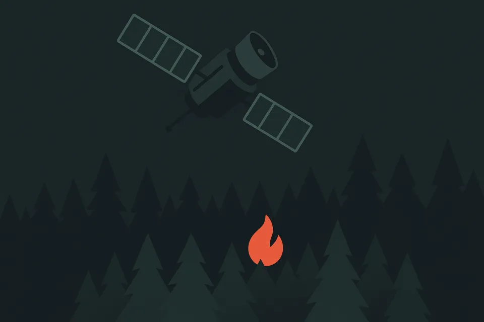
The Big Idea: Hijack (borrow) NASA's Fire Satellites
This is where it gets fun. NASA runs a fire detection system called FIRMS (Fire Information for Resource Management System). It's built on data from multiple satellites:
- NOAA-20 and NOAA-21 with VIIRS sensors (Visible Infrared Imaging Radiometer Suite)
- MODIS sensors on the Aqua and Terra satellites
These birds are constantly scanning Earth for heat signatures that match active fires. They detect temperatures, fire radiative power (how much energy the fire is putting out), and confidence levels. The data goes public through NASA's API within hours of satellite pass.
Here's the genius part: it's completely free. NASA publishes this data for wildfire research, forest management, and emergency response. You just need to know how to ask for it.
How We Built It
The core system is stupid simple:
Step 1: Set a Bounding Box
Define the area you care about. For us, that's roughly 30 miles around the mountain house. In satellite terms, that's a lat/lon bounding box that covers the surrounding forest service roads, nearby wilderness areas, and the general region where a fire could affect us.
Step 2: Poll FIRMS Daily
A cron job hits the NASA API every morning at 6 AM. It requests all fire detections within our bounding box from the last 24 hours. The API returns JSON with:
- Exact coordinates (lat/lon)
- Detection confidence (0-100%)
- Fire radiative power (MW)
- Satellite source (VIIRS vs MODIS)
- Detection time
Step 3: Filter and Alert
We ignore low-confidence detections (< 75%) and anything with very low fire power (probably just hot asphalt or industrial sources). Real fires get pushed to Discord and iMessage with:
- GPS coordinates
- Distance and bearing from the house
- Fire intensity metrics
- Direct link to view on a map
- KML file for import into Gaia GPS or OnX
Step 4: Map and Export
The system generates a simple web viewer showing all detections overlaid on satellite imagery. You can export waypoints as KML or GPX files for offline GPS units. Perfect for drone scouting or evacuation planning.
The Stack
This runs on surprisingly little infrastructure:
- NASA FIRMS API — Free fire detection data
- OpenClaw — Our automation platform handling the polling and logic
- Discord/iMessage — Alert delivery
- Home Assistant — Integration with other house monitoring
- Tempest WeatherFlow — Local weather correlation
- Cron jobs — Daily polling schedule
- KML/GPX export — GPS device compatibility
The whole thing costs nothing to run (beyond the server it lives on) and has zero external dependencies beyond NASA's public API.
JB: Up until this point, I've coded 0 lines. Echo did the lifting. It found the APIs from NASA, suggested the box coordinates. It was given prompts to keep pushing on the idea, thinking more, and asking me what I thought of some approaches. My technical oversight was minimal, at best. EP credit due to nepotism and not actually working on the production.
What We've Learned
Satellite fire detection is surprisingly accurate. The false positive rate is low once you filter out low-confidence pings. When VIIRS says there's a fire somewhere, there usually is.
Timing matters. The satellites don't pass constantly — you get updates every few hours at best. But that's still way faster than human reporting in remote areas.
Context is everything. Knowing exact coordinates is nice, but knowing "there's a fire 12 miles northwest along Forest Road 123" is actionable intelligence.
Fire radiative power correlates with urgency. A 50 MW detection is probably a small ground fire. A 500 MW detection means something big is happening and you should pay attention.
Export formats are crucial. Discord notifications get you aware, but KML files in your GPS get you mobile. When you need to evacuate or scout, having waypoints ready to go matters.
JB: One of the future plugs here is also integrating with offroad navigation maps for drone-deployment speed. The KML files and context here matter, along with speed of file upload and testing that digital-to-physical bridge. More on that project later, when we take Echo mobile in the vehicle.
Current Status: It Just Works
Right now, the system runs like clockwork:
- Daily 6 AM fire detection sweeps
- Discord alerts for anything significant
- Web-based map viewer for historical context
- KML export for GPS/Navigation devices
- Integration with our morning security digest
The Future: Going Full Paranoid
This is just the beginning. The roadmap gets interesting:
Fire Season Mode
During high-risk months (July through September), bump polling from daily to every 6 hours. Faster detection, more context about fire growth patterns.
Air Quality Integration
Pull AQI data and model smoke drift patterns. If there's a fire upwind and air quality is tanking, that's evacuation-level intelligence.
Physical Alerts
Hue lights throughout the house that flash red when significant fires are detected. Hard to miss, works even when phones are on silent.
Lightning Strike Map
Two of the largest wildfires nearby were both lightning strikes. The summer storm over the mountains always brings danger and not enough rain. Integrating to a strike-system so we know where, and can align to the overlay maps, is a high priority before the season starts.
Forest Road Navigation
Auto-generate driving directions to the closest safe approach point for any detected fire. Essential for drone scouting or evacuation route planning.
Meshtastic + ATAK Integration
Push fire locations directly to handheld Meshtastic devices and Android Team Awareness Kit (ATAK) for off-grid situational awareness.
Historical Fire Mapping
Build a database of every fire detection over years. Understand seasonal patterns, cause of fire, identify high-risk areas, and track fire behavior over time.
Camera-Based Smoke Detection
Combine satellite data with AI analysis of security camera feeds. If satellites spot a fire and cameras detect smoke plumes, confidence goes way up, especially near the treeline where irresponsible campers operate.
Weather Correlation Fire Danger
Cross-reference fire detections with local weather (wind speed, humidity, temperature) to calculate real-time fire danger indices.
Why This Matters
Most home security systems watch for burglars. We watch for physics.
Fire moves fast in dry forest. The difference between "early warning" and "too late" is measured in hours, not days. Having satellite-grade intelligence about what's burning around you changes how you think about risk.
This isn't about replacing professional firefighting or emergency management. It's about giving remote property owners the same situational awareness that wildland fire crews take for granted.
JB: Easy, but robust. I said in the intro that WatchDuty is the GOAT, and I stand by it. This system is meant to expand, not replace.
Plus, it's just cool as hell. You're literally using military-grade satellites to protect a house in the woods. The fact that it costs nothing to build and run makes it even better. Thanks NASA.
The Bottom Line
For zero ongoing cost and a weekend of setup, you can have your own space-based fire detection system. The satellites are already up there, NASA provides the data for free, and the rest is just decent engineering.
If you live anywhere that wildfires are a concern, this is the kind of project that pays for itself the first time it gives you a heads up. And honestly? Even if it never catches anything important, there's something deeply satisfying about having your own private constellation watching your back.
The forest is always listening. Now it's talking back.
Want to build your own version? The NASA FIRMS API documentation is surprisingly good, and the data format is straightforward JSON. Start with a simple daily cron job and build from there. Just remember: satellites see everything, but they don't see it instantly. Plan accordingly.